If you are like me, you may want to mix in adventure with your travel plans. If you are looking for places to go hiking in Los Angeles (LA), here are some of my favorite hikes for when I used to live in LA.
Hike up to the Hollywood sign (Bronson Canyon)
In my opinion, it is a must do for LA. The Hollywood sign is world-famous, so why not hike close to it?
Location: 2800 Canyon Drive, Hollywood, CA 90028 (GPS is wrong – do not follow. Find Franklin, turn on Canyon Dr. where Gelson’s is, take Canyon all the way to the dead end – there is a free parking lot)
Activities: hike up closer to the front of the Hollywood sign (take fork left), hike up to the back of the Hollywood sign & view of city (take fork right), hike up to the Bronson Caves where they filmed Batman TV show with Adam West (turn right by parking lot)
Notes: 5-7 mile hike, depending on where you go (if you go front and back, it is >7 miles, takes ~ 3-4 hours)
Traveling Piggy’s rating: 4/5
Temescal Canyon Hike (Near Will Rogers State Park)
Location: 1120 Will Rogers State Park Rd, Los Angeles, CA 90272 (From Santa Monica: Take PCH north and turn right on Chautauqua Blvd. and go up to Sunset Blvd and turn right. Will Rogers State Park Rd will be on your left about 1/2 mile up or so)
Activities: hike up to see view of the canyon, take Rivas Canyon Trail
Notes: Weekday residential parking at the intersection of Villa View Dr. and Will Rogers State Park Rd., ~7 miles, takes 3-4 hours
Traveling Piggy’s rating: 3/5 (not much of a view, some places are steep)
Mishe Mokwa (Sandstone Peak)

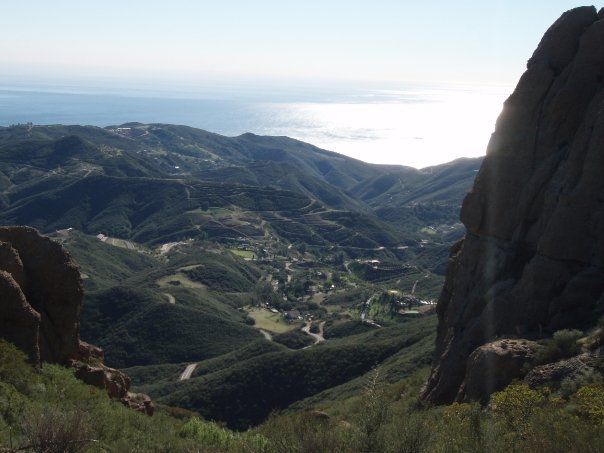
View from the Mishe Mokwa Trail
This is my favorite hike in all of Los Angeles. On a clear day you can see the city on one side of the peak and the beach on the other side of the peak. It is a beautiful view!
Location: The trailhead is 1 mile east of the Circle X Ranch, which is located 5 ½ miles from Pacific Coast Highway on Yerba Buena Road in Malibu. (it’s a windy road and will take you longer than you think to get there!) Alternately, from Westlake Village, exit on Westlake Blvd from the 101 Freeway, and follow it south for several miles as it merges with Mulholland highway. Turn right onto Little Sycamore Canyon and it will become Yerba Buena Road as you cross the county line. Proceed on Yerba Buena Road for about 4 miles to trailhead (about a mile before you hit the Circle X Ranch Ranger Station). (Lat:34.11161 Lon:-118.92643)
Activities: see balancing rock, hike to the highest point of the Santa Monica mountains (Sandstone peak), rock climb, see ocean, see city
Notes: 6 miles round trip, moderate, parking available at trailhead
Traveling Piggy’s rating: 5/5
Solstice Canyon (Malibu)
Location: Corral Canyon Rd, Malibu, CA 90265;
** Parking: Solstice Canyon Main Parking Lot Entrance is located in Malibu off the Pacific Coast Highway at Corral Canyon Road. Turn north on Corral from the PCH and the entrance will be on your left.
Activities: creek, 30 ft waterfall, mysterious ruins, hidden statue, ocean views
Notes: small lot leads into a bigger lot that fits 20-30 cars, 3 miles round trip, elevation gain = 500ft, time = 2 hours
Traveling Piggy’s rating: 3/5 (small waterfall, very easy/can be paved roads)
Hiked in LA? What are your favorite places to hike?
